If you ever felt nostalgic from piecing together old photos with locations on Google Maps then you will thoroughly enjoy this map.
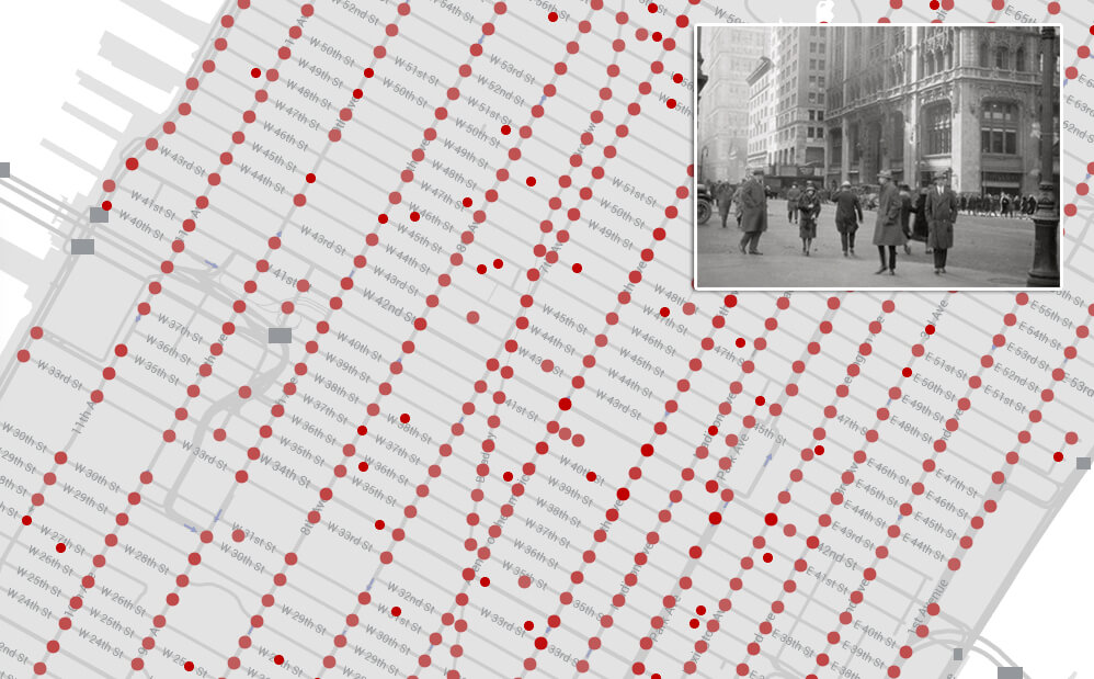
The New York Public Library has introduced a new interactive map project that takes its massive digitized archive of historical photos and plots them on a map. The project is called OldNYC – Mapping historical photos from the NYPL. You can click on each dot on the map to see a variety of vintage photos taken in that area years ago. The announcement was made earlier today by the data team over at NYPL.
It’s finally here! http://t.co/YxohiZK2ec
@danvdk’s collaboration to map @nypl’s street views of NYC!
See NY’s history of place!
— NYPL Labs (@nypl_labs) May 21, 2015
If you’re into maps and vintage photos, you need to check out the NYPL OldNYC amazing resource.
Click on the small image below to head over to the interactive map.