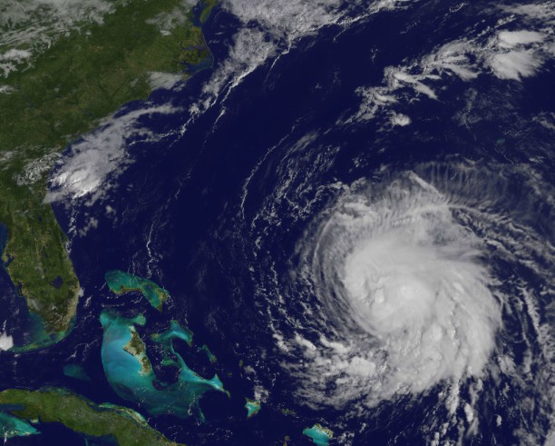
Matthew temporarily became the strongest hurricane in over a decade Friday night as winds peaked at 160 mph, exceeding Category 5 level. Hurricanes of that intensity are capable of catastrophic damage. The last storm to reach the strength of Matthew in the Atlantic basin was Hurricane Felix in 2007 with winds of 175 mph. An estimated 130 people died in that hurricane.
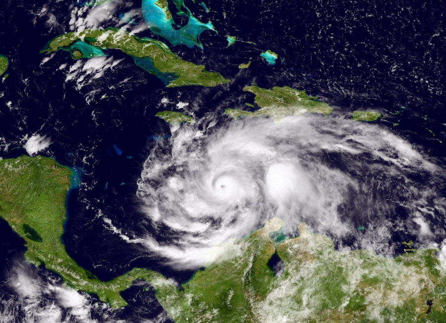
On Sunday, Matthew weakened to a very powerful Category 4 hurricane with winds of 145 mph, and still capable of widespread destruction. The intensity of Matthew will fluctuate over the next 48 hours as it interacts with the land masses of western Haiti, eastern Cuba and Jamaica. Haiti looks to be in the cross hairs of Matthew and by late today and tonight, the island nation could take on a deadly and devastating blow. Deforestation in Haiti has dramatically increased the potential for flooding and landslides. Many Haitians live in ramshackle homes that would be exposed to the wrath of Hurricane Matthew. If the storm stays on its projected track, Jamaica and eastern Cuba will take a major hit, but not as bad as Haiti. The most powerful quadrant of almost all hurricanes are on the northeast flank, which would put Haiti directly in its path. FUTURE TRACK OF MATTHEW
Matthews future track and intensity is still uncertain. Right now, we are pretty confident that once Matthew moves away from Jamaica, Haiti, and Cuba, it’s pretty certain that it will slam into the central Bahamas by Wednesday as at least a major hurricane with winds of around 125-130 mph. AFTER THE BAHAMAS
Most computer models agreethat Matthew will slowly move off the Florida coast by Thursday or Friday and not directly strike the state.
After that, models have a wide margin for error, but the consensus as of now (and as of now is very important to understand as its path is still uncertain) is that Matthew could buzz the South Carolina and North Carolina coasts by this coming weekend, and then either begin to veer more northeastward, sparing the Mid-Atlantic and Northeast of a direct strike. In another scenario, it could buzz off the coasts of the Carolinas, Virginia, New Jersey, Long Island, and southern New England by late in the weekend. A European model has it veering off the coast and actually then heading towards the coast of Maine by next week.
METEOROLOGICAL CONUNDRUM
The timing of a deep trough to swing from the Plains to the East Coast and exactly what position Matthew will be at the time will dictate Matthew’s future impact on the Northeast, whether it’s simply strong, gusty winds and tidal flooding along the coast, or something with much more of an impact, For now, the jury is still out. Boston
Today: Clouds and then sunny, 66
Tuesday: Developing sunshine, cool, 61
Wednesday: Sunny, 63
Thursday: Sunny, 66
Friday: Late clouds, 65
Weekend:Uncertain depending on the future track of Hurricane Matthew
New York
Today: Morning clouds, some afternoon sun, 72
Tuesday: Mostly cloudy, 68
Wednesday: Sunny, then cloudy, 70
Thursday: Sunshine, 73
Friday: Clouding up, breezy, 70
Weekend:Uncertain depending on the future track of Hurricane Matthew
Philadelphia
Today: Breaks of sun, showers, 74
Tuesday: Mostly cloudy, 70
Wednesday: Clouds and sun, 70
Thursday: Clouds and sun, 72
Friday: Clouds, breezy, 71
WEEKEND:Uncertain depending on the future track of Hurricane Matthew.
Bolaris Weather Watch: Matthew tearing through Caribbean
Getty Images