It certainly didn’t take too long to turn early-season optimism into a January malaise. Warm temperatures and rain put a damper on the landscape last week, just in time to prepare for the MLK holiday weekend, which greeted guests with icy conditions across New England. It wasn’t good news for local ski areas, likening the trails to your local outdoor skating destination. That likely kept a good number of people away from the hills, expecting slick skiing and riding, not to mention more crowded slopes than usual. Instead of welcoming the masses for the long weekend, most resorts found themselves making snow in an effort to catch up where last week’s thaw did its damage. On Saturday, Josh Fox of the incomparable Single Chair Weather Blog, located in the heart of Vermont, pointed out that the pattern “still looks like garbage for the next 10 days or so.” So … not great. RELATED: Downhill Report: Ski resolutions for 2017 Or … maybe not. We’re logistically about halfway through the 2016-17 skiing and riding season here in the Northeast (less than halfway if some of us have anything to say about it), and this past week-plus is really the only bummer that we’ve had yet to speak of. It’s a kick to the gut that the worst week weather-wise here in New England would come as we’re stuck watching the Lake Tahoe region receive upwards of 20 feet of snow. But at least we didn’t have to dig out from that Armageddon. So, there’s that too. Besides, there are already some signs that Fox’s prognosis of doom and gloom over the next week or so may already be shifting into a positive direction. On Monday, Fox noted that change in the forecast has snuck up on him, predicting 5-8 inches of powder in the higher elevations of Vermont. Likewise, the National Weather Service issued a weather alert for eastern New Hampshire that was due to deliver 4-8 inches of snow — and possibly sleet — Tuesday evening into Wednesday afternoon, perhaps meaning a bit of a replenishment for places like Crotched Mountain and Pats Peak. Other forecasts put portions of Maine, including Sunday River, in the range of 9-12 inches from the same storm. RELATED:Why 2017 should be the year you learn how to ski That’s good for base-building, most specifically. But any hope for a midweek powder day is probably going to be left out in the cold.
It’s also an indication of every winter in New England. Just when the thaw comes threatening your livelihood, there’s a turn around the corner.
For instance, as of Jan. 25 two years ago, the Boston area had seen 10.6 inches of snow. That’s about the same amount that the Jan. 7 storm deposited in areas of Massachusetts.
Of course, that 10.6 inches two years ago eventually turned into a record winter that brought a record-breaking 108.6 inches of snow to Boston. Or, do you not remember?
Last winter’s dud of a ski season may still be fresh in your mind, but the events of two years ago are the most recent reason to understand that a January thaw does not mean the end of a ski season. Not by any stretch. As for being halfway through the season, talk to me in February and we’ll see where we are.
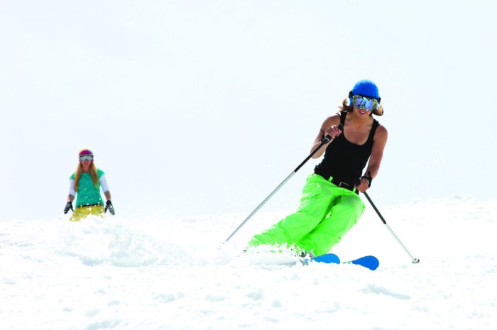
Skiers: We’re facing the dreaded thaw

iStock