The month of February is expected to go out in a miserable wintery mix resulting in a cold, snowy fury.
The weekend’s wild winds, which left around 68,000 customers without power on Monday, will have died down by Tuesday evening.
The Massachusetts Emergency Management Agency reported that Cambridge, Tyngsboro, Revere, and Westford were hit hardest, with gusts topping out near 70 mph.
The National Weather Service reported that Monday’s gusts reached sustained speeds between 25 and 35 mph, and topped out at 67 mph at the Blue Hills in Milton, 66 mph in North Adams, and 60 mph in Worcester. As of 7 a.m. Tuesday, MEMA reported 24,867 homes experiencing power outages. Some town reported entire areas experiencing near-total outages throughout Western Massachusetts, including 99 percent of households in Worthington in Hampshire County and in the adjacent town of Chester in Hampden County.
While the wind may settle down, a cold front looms with snow on its way.
Experts predict a chance of snow, mainly after 4 p.m. on Wednesday with a high near 25 and wind chill reaching as low as -5 to -15 degrees.
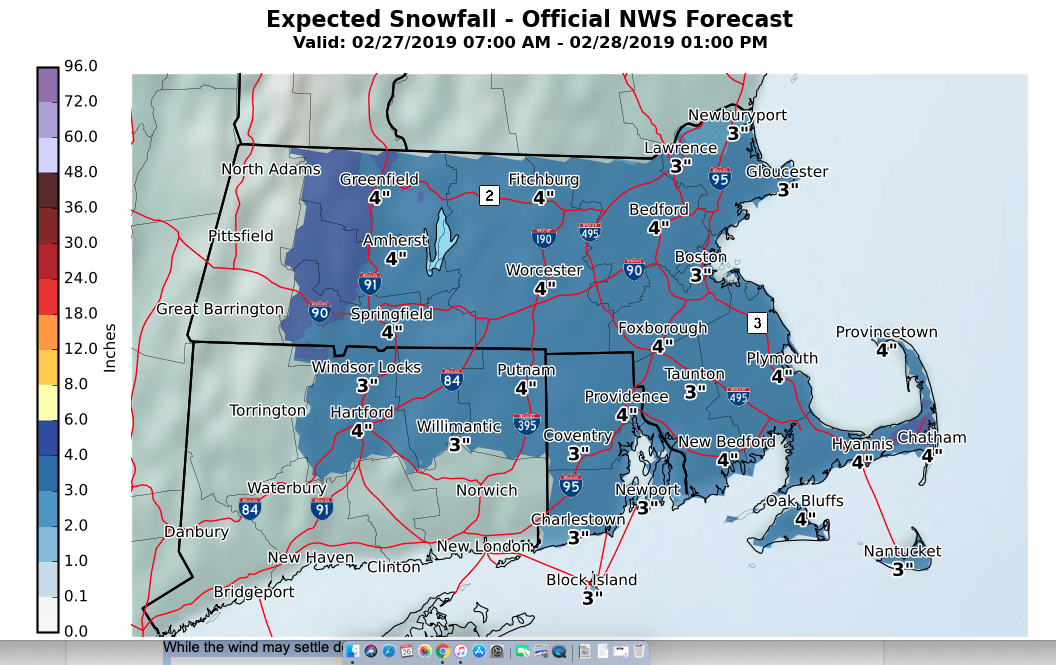
Experts say that the winds will calm down as the snow first arrives. Wednesday’s snowfall isn’t expected to add up to much during the day, but storms are expected to reach the Boston area between 5 a.m. and 9 a.m., dumping between 2 to 4 inches right in time for Thursday morning’s rush hour commute.
Temperatures are supposed to hit highs near freezing, and lows in the 20’s.
The highest totals will be in Western Massachusetts, reaching near 5 inches west of I-91. The rest of the Bay State is expected to be blanketed by least 3-4 inches of snow.
The storm is expected clear out but Thursday evening. Friday should be cold and grey, with light winds and temperatures between 37 and 26 degrees. Rain is expected to hit the area late Saturday morning, with a high of in the low 40’s. A rainy/snowy mix will continue into Sunday morning before giving way to sunny afternoon.