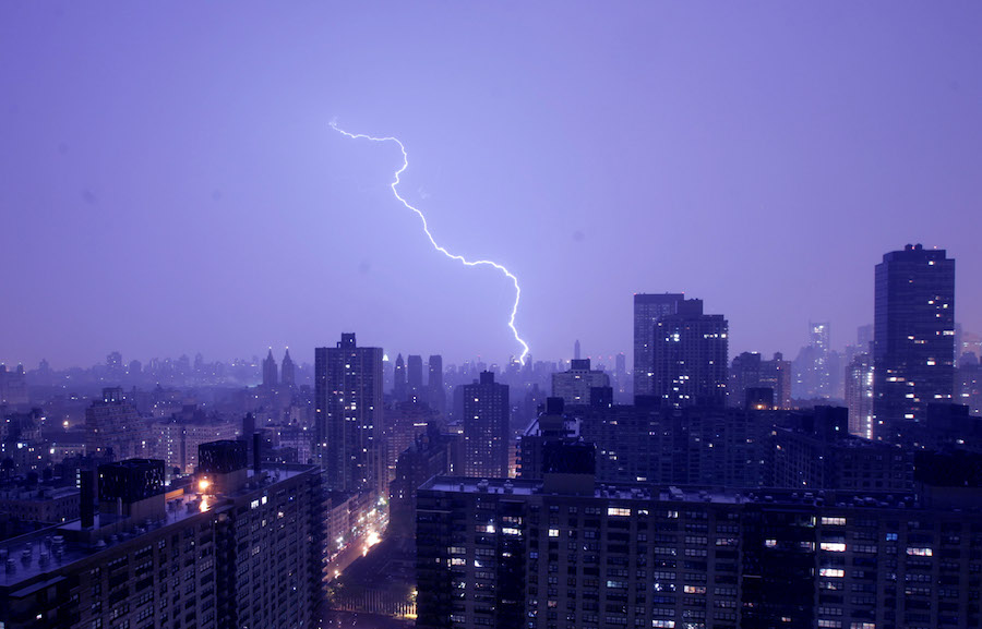
Here we are again, facing a risk of strong, if not severe thunderstorms far too early in the year.
While the number of February thunderstorm-days for the Tri-State area is likely less than one, that number creeps up ever so slightly in March. In fact, it’s ironic that our second shot at thunderstorms within five days comes today, the first day of the month, the start of meteorological spring. As I mentioned on Monday, Saturday’s raging line of squall lines, microbursts, and damaging winds had much of its bravado deflated by the time it reached the city and Long Island. Our morning fog and low, dull stratus cloud cover deprived the storms of their fuel, adequate sunshine, reducing them to a line of torrential rain. Today, our meteorological template is similar: morning fog, mist, raindrops along a warm front – and flow right off the ocean – with a cold front that has produced severe storms with tornadoes to our west. If the sun doesn’t break through early enough, and the warm front is too sluggish, our big afternoon warmup will be delayed. That might weaken our first chance at storms early this afternoon with the passage of a pre-frontal disturbance from the west. Our second shot at truly rowdy storms looks to come after dark, right with the cold front itself. If we get enough afternoon sun and warm air pooling, then the front’s powerful lift of the warmer air could light up our evening skies, with strong straight-line winds and possible small hail! Of course, one important ingredient in strong thunderstorms is a stark air mass clash. We’ve got a doozy coming in! We’re right back to late winter tomorrow as temperatures tumble through the 30s. It’s another piece of Arctic air. But our strengthening sun combined with an abnormally tepid Arctic will help to usher the cold air out quickly. Temperatures will already moderate this weekend.
WeatherTalk: Another bout of crazy weather
Getty Images