A new photographic project called “All Colors of the World” aims to unite the planet through satellite images. Italian artist Max Serradifalco uses pictures of natural landscapes from around the world to recreate the national flags of various countries. What’s the story behind “All Colors of the World?”
The “All Colors of the World” satellite flags are the result of one year of research into the theme of a life journey on Earth and of the people that inhabit the earth.
How did you go about making these images?
I used the colors of the Earth — found via Google Maps—like a painter would use the colors of their palette. The connection is conceptual: the identity of a country, through its flag, is reassembled by the rest of the world. After choosing the place I want to photograph, I make individual high resolution screenshots and then I cut them and combine them using Photoshop to create the flag of that country in the Earth version. What is the message of this project?
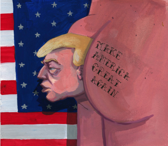
The most important common message that I would like to convey is to rediscover the ancestral, natural beauty of the Earth in 21st century modernity. Specifically in regard to the project “All Colors of the World,” I said: “Let’s imagine a world where a person is first considered an inhabitant of the Earth and then a citizen of a nation. A world where we are all brothers in sharing diversity, joy and the colors and energy of life.” What do you think about Donald Trump’s plans to build walls to separate people?
I think it is wrong. This is a very delicate issue. It is clear that territorial control is necessary and that we cannot all go to the same country. Cultural improvement by mankind at a global level would be necessary, but I am only an artist. —Daniel Casillas
Sports
 Sixers beat the Heat, secure playoff spot to face the Knicks
- Holmstrom scores late winner, Palmieri notches 30th as Islanders beat Penguins 5-4 in regular-season finale
 Kimmich heads Bayern Munich past Arsenal and into Champions League semifinals
 Real Madrid beats Man City 4-3 on penalties to advance to the Champions League semifinals
- Yankees rally in 9th, Judge breaks out of slump in 6-4 win over Blue Jays to avoid sweep
News
 Sydney shopping mall reopens after stabbings. Police make first arrest in riot after church attack
 Poland’s president becomes the latest leader to visit Donald Trump as allies eye a possible return
- SEPTA offers $2.6B budget, needs Harrisburg’s help
 Democrats clear path to bring proposed repeal of Arizona’s near-total abortion ban to a vote
 California sets long-awaited drinking water limit for ‘Erin Brockovich’ contaminant

More from our Sister Sites