In the future, when Kim Kardashian is but a confusing moment in human history, and the oceans have risen to unimaginable heights will your New York City neighborhood survive? Probably not.
Seattle based urban planner, Jeffrey Linn, who’s also drawn up underwater maps of other coastal cities like Seattle and San Francisco, has published a new map that imagines a drowned New York City. The few remaining neighborhoods: the Upper West Side, some corners of the Bronx and outer Brooklyn, have all been given new names. For instance, there’s CUNY Island, Columbia Island, and University Neck. In addition to these surviving neighborhoods a huge chunk of land known as “Jersey Island” survives. Though we doubt people would want to commute by boat from there. Better start buying up some land uptown for that future waterfront home of yours.
See the rest of Linn’s work, including other maps of cities underwater, on his website here.
MAP: Which NYC neighborhoods will be underwater in the future? Probably all of them
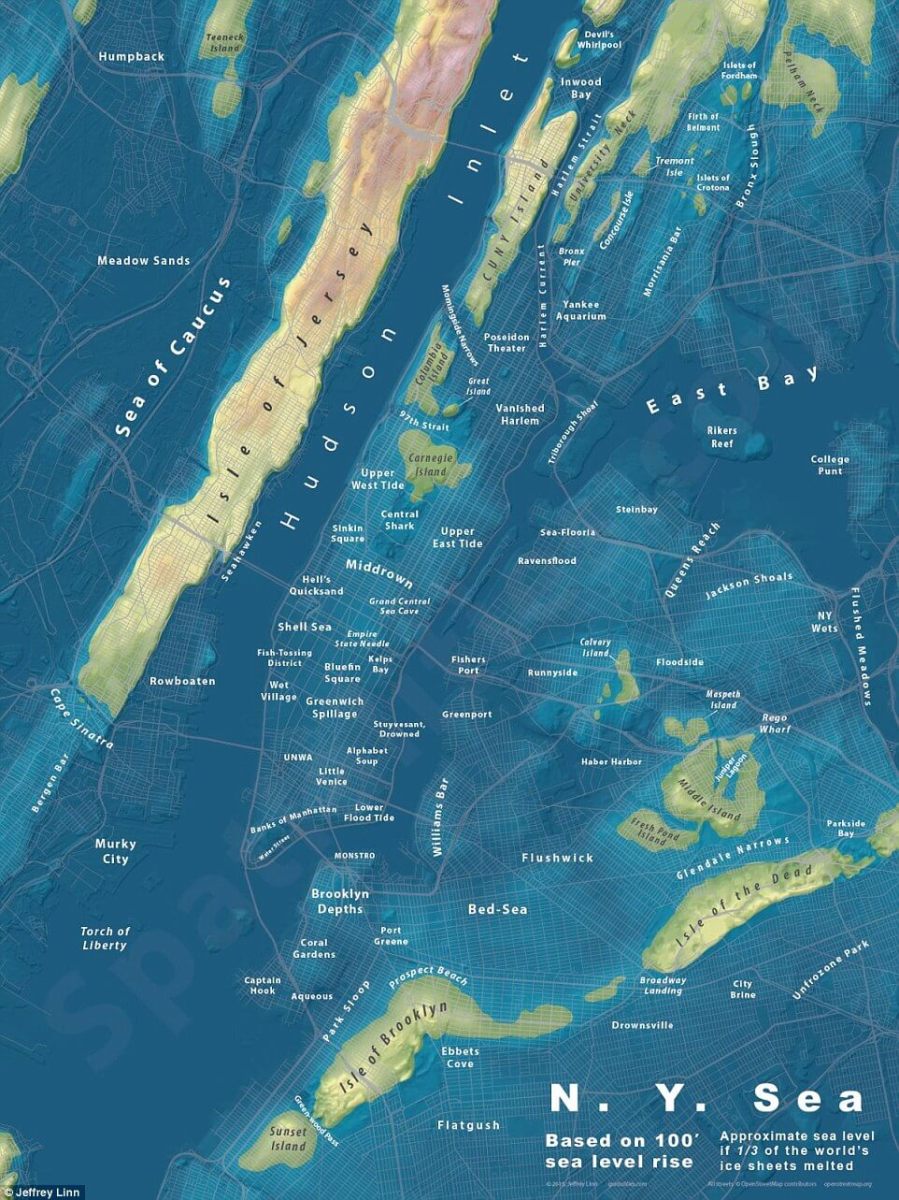
Jeffrey Linn