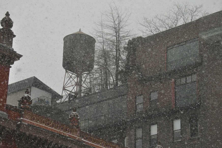
We hope you haven’t stored your winter gear away just yet. Despite the fact that spring has officially sprung, wintery weather going by the name Winter Storm Toby — aka the area’s fourth nor’easter of the month — is slated to drop more than a foot of snow on the New York City region.
“To have four nor’easters in as many weeks is an exceedingly rare occurrence, and you can almost hear the collective muttering along the I-95 corridor,” Carl Parker, on-camera meteorologist from The Weather Channel, told Metro. “This storm will take aim on the Mid-Atlantic region, dumping more than a foot of snow in parts of northern Virginia and Maryland, southeast Pennsylvania, central Jersey and Long Island. Strong northeast winds will develop on Wednesday, gusting to 40 to 50 mph in Boston and Nantucket from late Wednesday through Thursday morning. Minor to moderate coastal flooding is expected from Delaware to Maine.”
Early Tuesday morning, the National Weather Service issued a Winter Storm Warning for parts of northeast New Jersey and southeast New York — including Westchester and its surrounding areas as well as across New York City’s five boroughs — that begins at midnight and will be in effect until 8 a.m. Thursday.
The warning “means significant amounts of snow, sleet and ice will make travel very hazardous or impossible,” the NWS said.
In anticipation of the storm’s severity, all New York City public schools will be closed on Wednesday, officials announced just before 6 p.m. Tuesday. After-school programs, adult education, YABC programs and PSAL activities were canceled, and SAT School Day administration has been postponed until April 24.
Forecasters expect heavy mixed winter precipitation that will turn into heavy snow that could drop between 12 and 16 inches across the region. Light ice accumulation is expected in some parts as well.
The fun starts Tuesday afternoon, when we have a slight chance of rain until about 11 p.m., then snow will be added to the mix until around 3 a.m., when snow, freezing rain and sleet are expected.
While snow and sleet are expected to accumulate less than an inch overnight, the area will experience wind gusts as high as 34 mph, the NWS said.
The wintery mix will turn to snow in time for Wednesday morning’s commute, and we might even experience thundersnow again as we did during the nor’easter that hit the area earlier this month.
Wind gusts above 30 mph are expected to remain through Thursday afternoon, but forecasters anticipate we’ll see the snow stop before midnight, and partly sunny skies will return that morning.
But don’t get too used to that. While Friday and Saturday will be mostly sunny with temps in the mid-40s, we may see some snow and rain again Saturday night into Sunday.
Forecasters expect the current active weather pattern could continue through the rest of March, bringing more cold, wet weather to the Northeast.